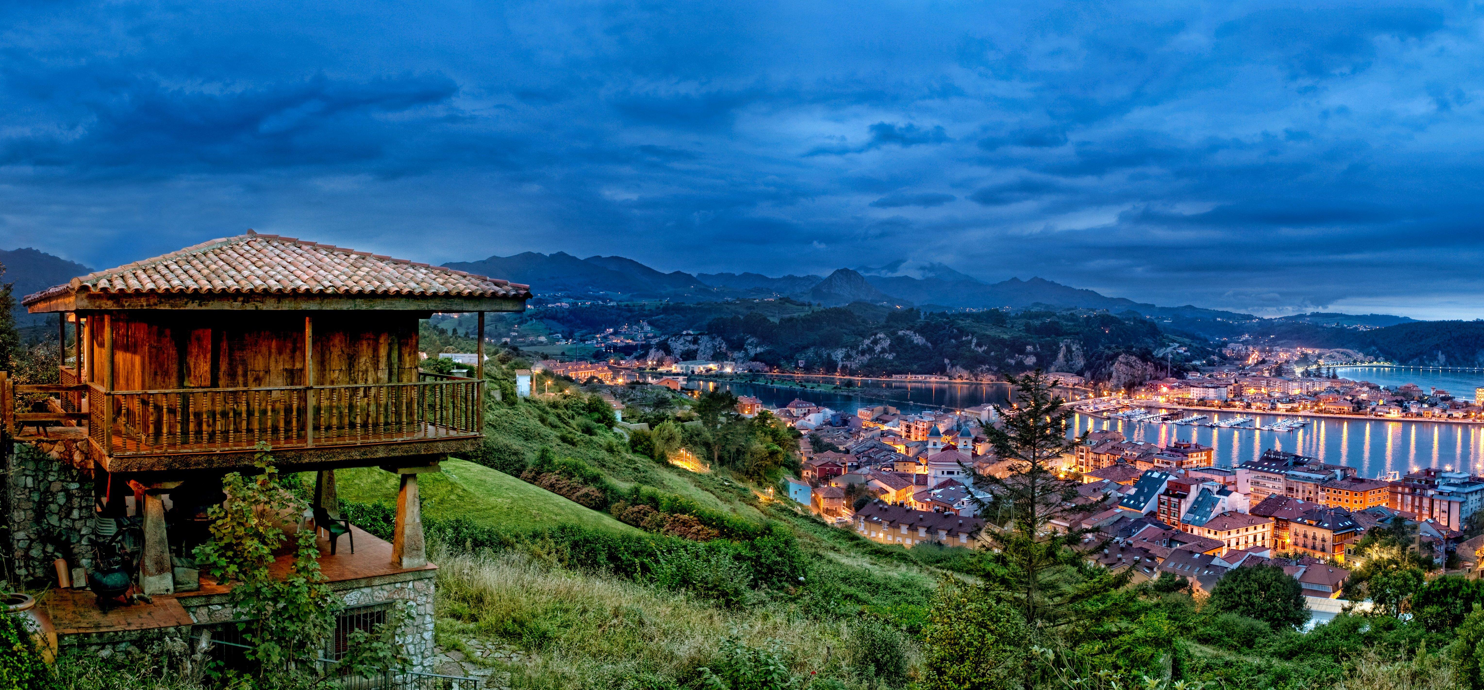
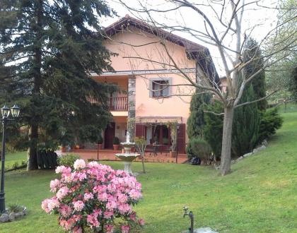
La Bahúa. Casa de Aldea Compartida

- Address: Cuerres
- Telephone: 639 692 680
- Email: enriquevila8@hotmail.com
- Capacity: 7/15
- Opening date: 2003

Contact


View map

Don't miss it
-
0.7 km
Easy level hiking path, from Cuerres village to Guadamía beach. Length: 4 km.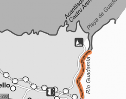 This 4 km long route starts at Cuerres village, so to get there you will have to drive along AS263 to the eastern limit of Ribadesella’s borough.The starting point of your walk is th
0.7 km
Moderate level hiking route. The Way of Saint James’ northern route crosses along Ribadesella’s borough, from east to west. Nature, ethnography, history and architecture can be enjoyed. Total length: 15 km.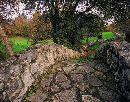 The Way of Saint James route starts in Cuerres, the first village on the eastern part of the district. To get there, you have to drive 6 km from Ribadesella to the east, along AS-263 road.<
1.8 km
Limestone coastal massif with some vertical dramatic cliffs and a picnic area. With strong high tides you can enjoy the Bufones, an impressive and unusual Nature’s water show.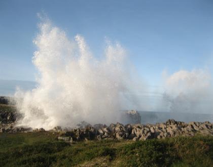 Castru Arenes picnic area is a vast nude surface at the top of a magnificent calcareous platform, actually a privileged viewpoint to look over the Cantabrian Sea. El Cuera Mountains behind you, a
4.1 km
Spectacular cliffs and picnic area on the countryside where enjoying a mixed marine/mountain impressive panorama.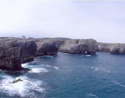 L’Infiernu picnic area is a recreational zone on the countryside, beside the coastline. From this area a short trail to the north take you to L’Infiernu stony cliffs, with their dramatic soar
6.6 km
Accessible stony beach by the Old Village quarter.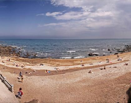 This cosy stony beach is formed by flat loam rocks at the foot of the Jurassic cliffs that involve the old village. Perfect for sunbathing during the summertime, it is really easy to get there fr
6.7 km
The interior of Santa María Magdalena parish church houses an unexpected 20th century fresco paintings masterpiece by the Uría-Aza brothers. Not to miss.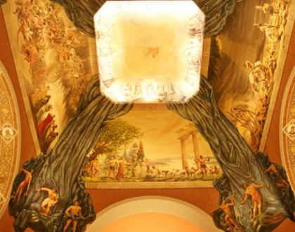 Built during the 20s decade, Santa María Magdalena parish church was projected in an eclectic style by the main architect in Ribadesella at the time: Miguel García-Lomas. Two distinctive bell t
6.8 km
Ribadesella’s old quarter is a rich ensemble of centenary traditional and bourgeois houses, popular squares, historic streets and tiny alleys, devised on its 13th century original settlement.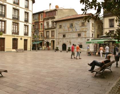 To find the oldest part of this village you have to stroll through the streets and alleys that are standing at the bottom of the hills, for this was Ribadesella’s original settlement. Walking a
6.8 km
Rula en funcionamiento acondicionada para visitas turísticas donde se muestran a través de paneles explicativos y reproducciones, distintas artes de pesca, así como el antiguo sistema de subasta del pescado.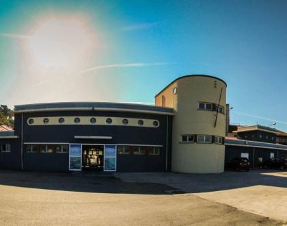
Fishing has historically been Ribadesella’s main industry. During the 20th century Ribadesella was one of the most important fishing harbours in the Cantabrian coast,
7 km
Promenade, monument and podium, where the winners of the Sella River’s International Canoeing Descent are awarded every year.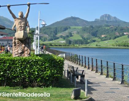 Les Piragües Festivity is the only celebration in Asturias declared as an International Interest Celebration by the Asturias government. Folk, tradition and sport are part of this renowned mass
7 km
Rural Romanesque church, with remarkable carved elements. Built in 13th century, it stands on a dominant viewpoint over the estuary of the Sella river.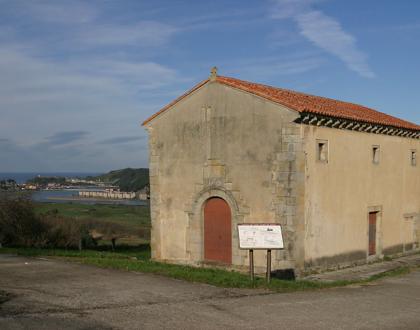 Xuncu village is the outstanding location of this rural stone church, at 5 km from Ribadesella. It offers a whole view over the estuary of the Sella River, and
7.4 km
Beautiful promenade by the sea at Santa Marina beach, with colonial and regional style villas from the beginning of 20th century.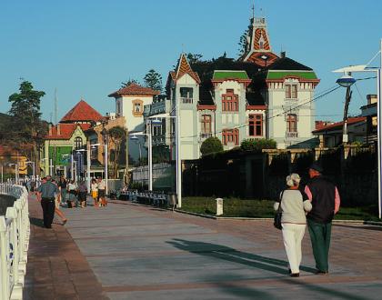 At the beginning of 20th century the western side of Ribadesella became one of the principal tourism destinations in Spain for nobility families. In the first decades of the century, the Marquise
7.5 km
Innovative Cave Art Centre with an appealing and pedagogical permanent exhibition presenting a precise global vision of Tito Bustillo UNESCO’s site.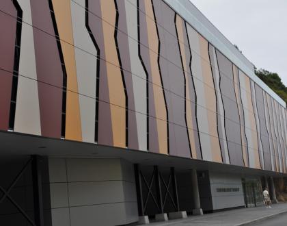
Lately, dissemination and protection of Palaeolithic heritage are being main reasons to create museums and replicas beside the principal Cave Art sites in the world. The novel permanent exhibition
7.5 km
Excellent and convenient white sand beach, bordered by a distinguished and beautiful promenade. It holds the Q Quality Certificate.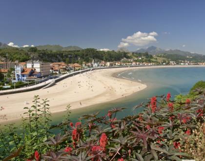 This 1 km long urban beach is considered the best sandy area for visitors in the district. It spreads from the left side of the estuary of the Sella River to the Jurassic layers of Somos hill, on
7.6 km
Chapel from the Renaissance built during the 16th century at the top of El Corveru hill. The best viewpoint of the village. A must see.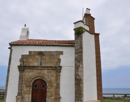 Altered in 1892, this 16th century construction is standing at the perfect point for a complete panoramic view over the Sella river’s estuary. The splendid southern façade still remains on its
7.6 km
Considered one of the most important prehistoric sanctuaries of Palaeolithic Cave Art in the world, in 2008 the UNESCO declared this cave a World Heritage Site. A must see.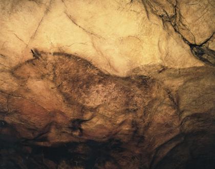
Tito Bustillo Cave is a part of the Ardines massif: a calcareous stone formation placed by the estuary of the Sella River. Pozu’l Ramu is the name of the crack on the top of the massif that was u
7.6 km
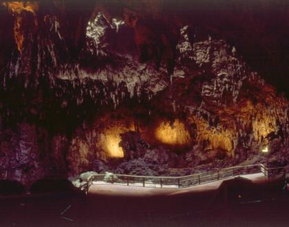 Formed by the collapse of several superposed galleries, its colossal main chamber stands there unexpectedly as a colossal 40 m high underground cupola. Open to the exterior on its ceiling, this n
7.6 km
Retired wetland and park, with a charming promenade provided with adapted posts for Birdwatching.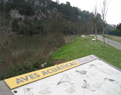 This natural area is an interesting remaining of a biologically rich vast wetland that was partially dried and filled during the 20th century. Twice a day Cantabrian sea high tides flood this mar
7.9 km
Moderate level hiking trail inside a Cantabrian forest where some restored structures of traditional watermills can be seen. Length: 9 km.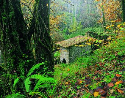 The starting point of this 9 km long route is Cueves del Agua village, where a signposted steep trail leads up to Monte Moru, the summit of your walk, beside Tresmonte village. Past 4 km you’ll
8 km
This magnificent cavern is the historical access to Cueves del Agua village. Its vaults and fanciful limestone formations make it worth a visit.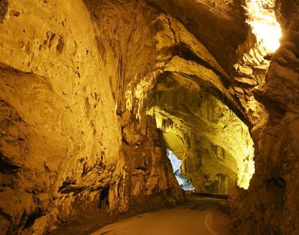 This 300 m long cavern is the only access the picturesque Cueves del Agua village has ever had. Its enormous gallery is the ancient course of Cueves stream whose modest waters are still visible r
8.2 km
At the top of the Ardines massif an extensive picnic area and three privileged viewpoints offer a vast panorama of Ribadesella village.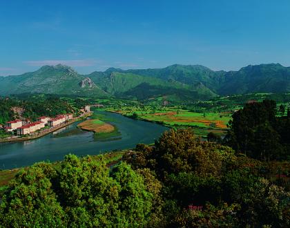 This picnic area at the top of the Ardines massif stands on a typical relief of calcareous undergrounds; and so, dolinas, caves and sinkholes are visible all around. Beneath your feet a complex n
9.4 km
Ruta de senderismo ,y apta para bicicleta, que recorre 11 kms de costa y pueblos de gran belleza.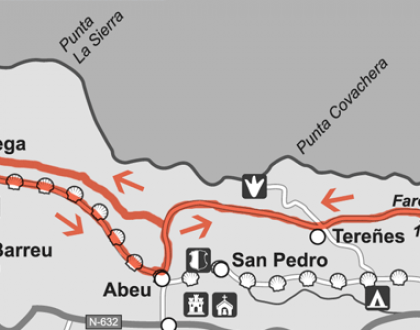
11 km, 3h, maximum difference in height: 150m, difficulty: low, without signaling
GPS coordinates lighthouse N 43º 28. 348 ', W 5º 04. 943'
GPS coordinates crossing Camino de Santiago
10.6 km
Rural Romanesque church from the 13th century. It houses an outstanding ensemble of unusual iconographic fresco paintings from the Renaissance.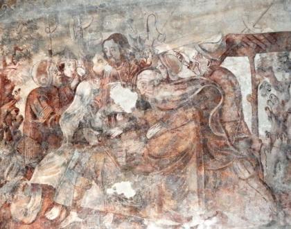 San Salvador de Moru is a modest 13th century construction in Romanesque style that was burned in 1936, during the Civil War. In the burning, the wooden roof of the unique nave collapsed, but not
11.1 km
Restored rural school with and interesting fossils' collection from the Ordovician period. Exhibition of pictures, models, and drawings that explain Ribadesella’s history.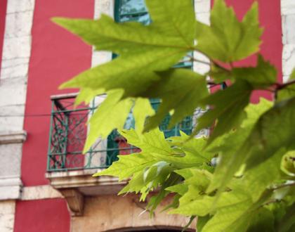 Originally, this museum was an old rural school built in 1900, and it stands as a paradigmatic example of what the hygiene movement gave to public buildings at that time: from that moment, b
11.7 km
En el pueblo de San Esteban. Es el solar de este linaje. Rodeada en la actualidad de construcciones añadidas, solamente es visible la fachada principal, que mira al norte hacia la iglesia cercana de San Esteban.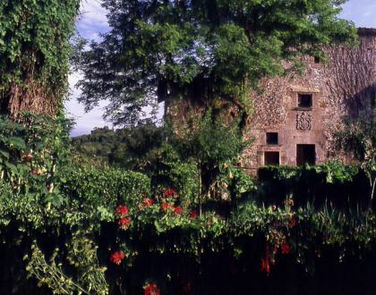 Located in the village of San Esteban, on the site belonging to this lineage. Surrounded nowadays by added constructions, only the main façade is visible, which faces north towards the nearby churc
14 km
The longest beach in the district with a virgin system of sand dunes, and an impressive formation of quartzite pinnacles. Both sites have been declared a Natural Monument by the Asturian government.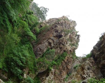
The Entrepeñes defile is an unexpected stony panorama carved alternately by the Acebu stream waters and the activity of marine tides. The magnificent geological formations rise up from the course
15 km
The longest beach in the district with a virgin system of sand dunes, and an impressive formation of quartzite pinnacles. Both sites have been declared a Natural Monument by the Asturian government.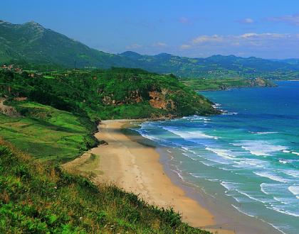 Vega beach is a beautiful 1,5 km long sandy beach that spreads at the end of the Acebu stream. This vast natural zone conserves a valuable non altered dune ecosystem and some geological and paleoEnjoyHave funEnjoyHave funen
