The asturian horreo

Beschreibung
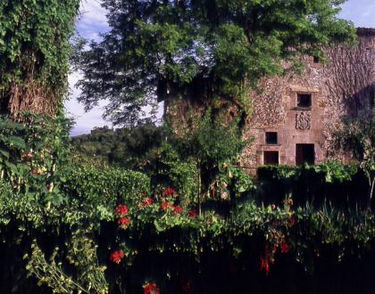
Located in the village of San Esteban, on the site belonging to this lineage. Surrounded
nowadays by added constructions, only the main façade is visible, which faces north towards
the nearby church of San Esteban.
Tampoco os aparecerá la versión en inglés del POI número 29: RUTA DE SENDERISMO DEL
FARO A VEGA:
WALK FROM THE LIGHTHOUSE TO VEGA VILLAGE
11 km, 3h, maximum difference in height: 150m, difficulty: low, without signaling
GPS coordinates lighthouse N 43º 28. 348 ', W 5º 04. 943'
GPS coordinates crossing Camino de Santiago with Abéu N 43º 28. 469 '- W 5º 07.550'
Suitable for bicycle.
We begin next to the lighthouse. At 250m we turn right towards Tereñes. From Tereñes, we
continue to the right along the road that reaches Abéu. After the first houses, we turn right
onto a gravel track marked with a yellow arrow on the stone and recognizable by the natural
gas driving poles. In a few meters we reach the crossing of the Camino de Santiago. We turn
right along the cobblestone road to reach Vega at its highest point and go down to the beach.
We return later on our steps; we left behind the crossing that would make us return to Abéu to
follow the Camino de Santiago. A few meters further on we turn to the left. At the next
crossroads again to the left, abandoning the Camino de Santiago. We crossed Abéu through
the central street until we passed a concrete washroom on the left bank. Just opposite there is
a path between walls that leads to the road that leads us back to the lighthouse.
En el pueblo de San Esteban. Es el solar de este linaje. Rodeada en la actualidad de construcciones añadidas, solamente es visible la fachada principal, que mira al norte hacia la iglesia cercana de San Esteban.
Located in the village of San Esteban, on the site belonging to this lineage. Surrounded
nowadays by added constructions, only the main façade is visible, which faces north towards
the nearby church of San Esteban.
Tampoco os aparecerá la versión en inglés del POI número 29: RUTA DE SENDERISMO DEL
FARO A VEGA:
WALK FROM THE LIGHTHOUSE TO VEGA VILLAGE
11 km, 3h, maximum difference in height: 150m, difficulty: low, without signaling
GPS coordinates lighthouse N 43º 28. 348 ', W 5º 04. 943'
GPS coordinates crossing Camino de Santiago with Abéu N 43º 28. 469 '- W 5º 07.550'
Suitable for bicycle.
We begin next to the lighthouse. At 250m we turn right towards Tereñes. From Tereñes, we
continue to the right along the road that reaches Abéu. After the first houses, we turn right
onto a gravel track marked with a yellow arrow on the stone and recognizable by the natural
gas driving poles. In a few meters we reach the crossing of the Camino de Santiago. We turn
right along the cobblestone road to reach Vega at its highest point and go down to the beach.
We return later on our steps; we left behind the crossing that would make us return to Abéu to
follow the Camino de Santiago. A few meters further on we turn to the left. At the next
crossroads again to the left, abandoning the Camino de Santiago. We crossed Abéu through
the central street until we passed a concrete washroom on the left bank. Just opposite there is
a path between walls that leads to the road that leads us back to the lighthouse.

Kontakt


